
Let me guess… you thought Oklahoma was just flat farmland and oil derricks, right? Surprise! The state actually packs over 1,000 miles of designated scenic byways that'll make your Instagram followers think you've teleported to Colorado or Arkansas.
Why Oklahoma's drives deserve your gas money
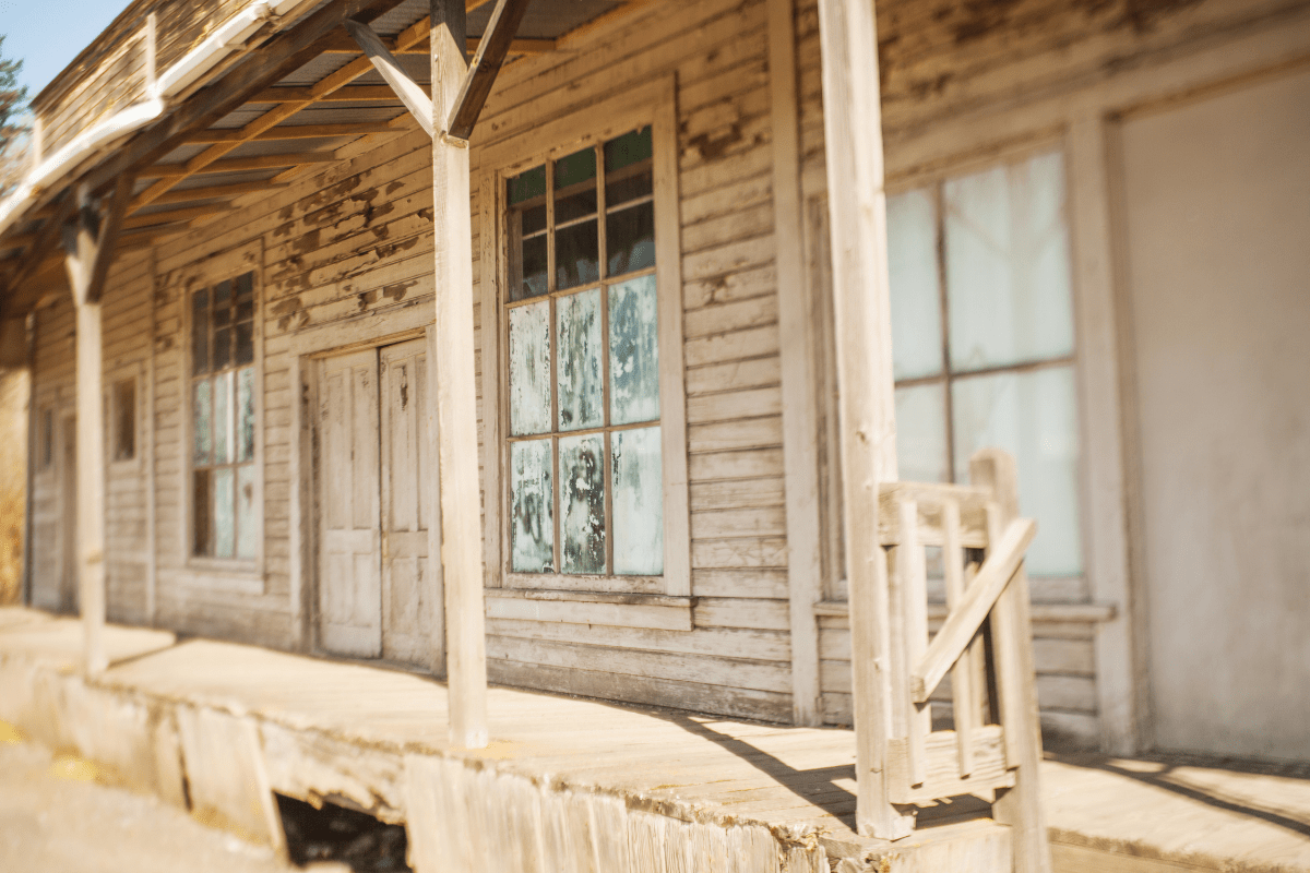
Here's what blew my mind when I started exploring Oklahoma's backroads: this state has the longest driveable stretch of Route 66 in America. Not California. Not Arizona. Oklahoma. We're talking 400+ miles of neon signs, quirky roadside attractions, and small towns frozen in the 1950s.
But wait, there's more (as they say on late-night TV). The state serves up ancient mountains reaching 2,600 feet, crystal-clear lakes with 1,300 miles of shoreline, and geological formations that look like they belong on Mars. The Ouachita Mountains in the southeast? They're older than the Rockies and deliver fall colors that rival Vermont… without the Vermont prices.
The Talimena National Scenic Byway: Oklahoma's worst-kept secret
Planning your mountain adventure
The Talimena might just be the most spectacular drive you've never heard of. This 54-mile mountain road connects Talihina, Oklahoma to Mena, Arkansas, climbing through the Ouachita National Forest to 2,681 feet at Rich Mountain. That's the highest drive between the Appalachians and the Rockies, folks.
Here's the thing nobody tells you: there are absolutely no gas stations along the entire route. Zero. Zilch. Nada. I learned this the hard way when my gas light came on at mile marker 15. Fill up in Talihina before you start, or you'll be that person walking down the mountain with a red gas can.
The Oklahoma portion spans 36 miles and takes about an hour and 10 minutes if you drive straight through. But who does that? You'll want to stop at all 22 scenic overlooks, each offering its own personality. Panorama Vista serves up sweeping valley views, Sugarloaf Vista shows off bizarre rock formations, and Sunset Point Vista… well, you can probably guess what that one's good for.
When to go (and when to absolutely not go)
Fall foliage peaks from the last week of October through the first week of November. This is when seemingly every photographer in a three-state radius descends on the byway. The colors are insane, but so are the crowds. Pro tip: hit the road on a weekday morning if possible.
Spring wildflowers bloom from mid-to-late April, creating a completely different but equally stunning experience. Winter? The road sometimes closes due to ice and snow. Summer works fine, though the views get a bit hazy when it's 95 degrees and humid.
Restroom stops are strategically placed at:
- West End Visitor Information Station
- Old Military Road
- Horsethief Spring picnic area
- Winding Stair Recreation Area
Yes, RVs can handle the route, though you'll be going slow on some of those curves. Watch for low-hanging branches that seem determined to give your rig a new sunroof.
Route 66: More than just a song lyric
The ultimate American road trip, Oklahoma style
Oklahoma owns more driveable miles of the Mother Road than any state. The historic highway enters near Quapaw in the northeast corner and exits 400+ miles later at Texola near the Texas border, passing through 69 towns that look like movie sets.
The route breaks down into two main chunks. From the Kansas border to Oklahoma City covers 225 miles, then it's another 157 miles from OKC to Texas. Unlike the Talimena, you'll find gas stations, diners, and motels every 20-30 miles. Many still sport their original neon signs, which light up beautifully at dusk (photographers, take note).
Must-see stops that aren't tourist traps (mostly)
The Blue Whale of Catoosa might be the most photographed roadside attraction in Oklahoma. This 80-foot-long smiling whale sits at 2600 Route 66 and costs exactly nothing to visit. It's open 24/7, which means you can get that perfect sunrise shot without fighting crowds.
Other essentials include:
- The Round Barn in Arcadia
- POPS Restaurant's 66-foot LED soda bottle
- Oklahoma Route 66 Museum in Clinton
- The original 9-foot "Ribbon Road" sections
The Route 66 Museum at 2717 W Gary Blvd in Clinton charges about $7 for adults and opens Monday through Saturday, 9am to 5pm (February through October, with reduced winter hours). It's actually worth the price… they have an entire drive-in theater setup inside.
Wildlife, mountains, and "did that bison just cross the road?"
Wichita Mountains Wildlife Refuge: Yellowstone's underachieving cousin
Okay, maybe that's unfair. The Wichita Mountains pack plenty of punch into their 59,020 acres. These 550-million-year-old granite peaks host 650 free-roaming bison, 300 Texas longhorn cattle, and 400 elk. Best part? Admission is completely free.
Enter via Highway 49 from Interstate 44's exit 45. The refuge opens at sunrise and closes at sunset, which sounds restrictive until you realize that's actually when the animals are most active anyway. The 29-mile scenic drive through the refuge offers multiple wildlife viewing opportunities.
Mount Scott Road provides the marquee experience: a 2.8-mile paved road that switchbacks up to 2,464 feet. On clear days, you can see all the way to Texas. Just remember this road closes at sunset and limits groups to eight people when open (apparently nine people viewing a sunset together would cause chaos).
Pro tips for not getting gored by a bison
Wildlife viewing peaks during early morning and late evening hours. French Lake and Lake Elmer Thomas attract the most animals, while Turkey Creek Prairie Dog Town near Elk Mountain guarantees entertainment. Those little guys put on quite a show.
The visitor center (GPS: 34.710644, -98.623426) sits 14 miles from the refuge gate. Stop here first for maps and current wildlife location updates. The rangers actually know where the bison herds are hanging out each day.
Medicine Park, just outside the east entrance, offers restaurants and lodging in America's only cobblestone community. Lawton, 15 miles southeast, has hospitals and every chain restaurant known to humanity. Summer temperatures regularly exceed 100°F, making spring and fall your best bets for comfortable hiking.
Lake country: Where Oklahomans pretend they live at the beach
Grand Lake and the world's longest multiple-arch dam
Grand Lake O' the Cherokees sounds like something from a fantasy novel, but this 46,500-acre lake with 1,300 miles of shoreline is very real. Highway 59 runs along the eastern shore from Afton to Grove, while Highway 10 provides scenic northeast views.
The showstopper comes when you cross Pensacola Dam via Highway 28. At 6,565 feet long, it holds the title of world's longest multiple-arch dam. Free tours run from 9am to 4pm daily during summer (Memorial Day through Labor Day).
Here's a secret: the area below the dam becomes bald eagle central from October through March. Bring binoculars and prepare to feel ridiculously patriotic.
Lake Tenkiller: Surprisingly clear water in landlocked Oklahoma
Twenty miles south of Grand Lake, Lake Tenkiller spans 12,900 acres with depths reaching 180 feet. The water clarity here legitimately supports scuba diving, which seems impossible for Oklahoma until you see it yourself.
Highway 100 provides a scenic 12-mile approach from Interstate 40. The route passes through Tenkiller State Park, where overlook trails offer panoramic views that'll make you forget you're nowhere near an ocean. Ten marinas and five floating restaurants serve the lake (because apparently Oklahomans really like eating on the water).
Western wonders that look like alien landscapes
Glass Mountains: Nature's disco ball
The Glass Mountains in Major County create an otherworldly landscape where selenite gypsum crystals sparkle like broken glass across mesa formations. Located 41 miles west of Enid via US Highway 412, Cathedral Mountain rises 150 feet above the plains.
The 1.2-mile round-trip trail gains 150 feet to the mesa top. It's not exactly Everest, but the views of Cheyenne Valley and the Cimarron River make it worthwhile. GPS coordinates (36.363094, -98.58036) will get you there, since road signs apparently aren't a priority in Major County.
Fair warning: there are exactly zero services at this free park. Fuel up in Fairview, 10 miles southeast, or risk becoming a permanent part of the landscape.
Black Mesa: Touch four states without leaving Oklahoma (sort of)
Out in the panhandle, Black Mesa rises to 4,973 feet, marking Oklahoma's highest point. Cimarron County is the only county in America touching four states, which is the kind of random trivia that wins bar bets.
The 8.5-mile round-trip hike from the trailhead takes 4+ hours and gains 600 feet. Switchbacks between miles 2.5 and 3.5 will test your cardiovascular fitness and your dedication to reaching arbitrary geographic high points. Stone monuments at the summit mark where Colorado, New Mexico, and Kansas borders converge.
Despite the remote location, paved roads lead all the way to the trailhead. Gas, however, requires planning. Kenton sits 5 miles away, while Boise City is 40 miles distant. Choose wisely.
Hidden gems for people who hate crowds
The Mountain Pass Scenic Byway along US Highway 259 connects Page to Octavia across 23 miles of Winding Stair Mountain National Recreation Area. Travel experts consider this route more beautiful than its famous neighbor, with fewer crowds to boot.
Highway 60's Osage Nation Heritage Trail spans 65-70 miles from Ponca City to Bartlesville. The route passes through Pawhuska, home to the Osage Nation Museum (America's oldest tribally-owned), and connects to the Tallgrass Prairie Preserve where 2,500 bison roam 39,650 acres.
The Cherokee Hills Scenic Byway follows Highway 10 for 84 miles, earning federal scenic byway designation. Natural Falls State Park along the route features a 77-foot waterfall that actually has water in it year-round (a minor miracle in Oklahoma).
When to visit (and when to stay home)
Seasonal breakdown for maximum enjoyment
Fall foliage peaks from late October through early November in the southeastern mountains. The northern regions and Osage Hills see colors slightly earlier, typically mid-to-late October. Spring wildflowers bloom from mid-April through early May, with Indian Blanket, Indian Paintbrush, and Plains Coreopsis creating natural carpets across prairie routes.
Summer brings brutal heat. We're talking 100°F+ temperatures that'll make you question your life choices. Lake routes provide some relief, but mountain drives become hazy and uncomfortable. Winter works well for wildlife viewing, especially bald eagles below dams, but some mountain roads close during ice storms.
Photography tips that actually work
Golden hour photographers should target Mount Scott summit in the Wichita Mountains and any of the Talimena's 22 overlooks. April brings American white pelicans to Grand Lake, while winter means bald eagles below every major dam.
For Route 66 neon signs, shoot at dusk when the lights pop against the darkening sky. The 11th Street Arkansas River Bridge in Tulsa offers classic Route 66 architecture worth capturing.
Practical stuff that'll save your road trip
Gas station planning can make or break your scenic drive experience. The Talimena Scenic Byway contains zero fuel stops along its entire 54-mile length. Western routes through sparsely populated areas often exceed 40 miles between towns. Route 66 and lake areas offer frequent services, typically every 20-30 miles.
Cell phone coverage remains reliable along major highways and near cities but becomes spotty in the Ouachita Mountains and remote western regions. Download offline maps before departing for mountain drives and panhandle explorations. Trust me on this one.
The Oklahoma DOT's Drive Oklahoma app provides real-time road conditions, essential during tornado season from April through June when the state averages 62 tornadoes annually. Yes, that's a real statistic. No, you probably won't see one. Probably.
Emergency services vary dramatically by region. Response times in remote areas can extend significantly, so basic first aid knowledge and supplies make sense. Also, tell someone where you're going. "Exploring Oklahoma" doesn't count as a specific enough itinerary.
Final thoughts from someone who's driven them all
Oklahoma's scenic drives reveal unexpected diversity across America's heartland. From ancient mountains and pristine lakes to endless prairies and historic highways, each route offers unique perspectives on natural beauty and cultural heritage. These aren't just roads; they're 1,000+ miles of carefully preserved adventures waiting for anyone willing to venture beyond the interstate.
Just remember to check your gas gauge, download those offline maps, and maybe pack some snacks. Oklahoma's scenic treasures reward the prepared traveler… and occasionally forgive the unprepared one. But why risk it?