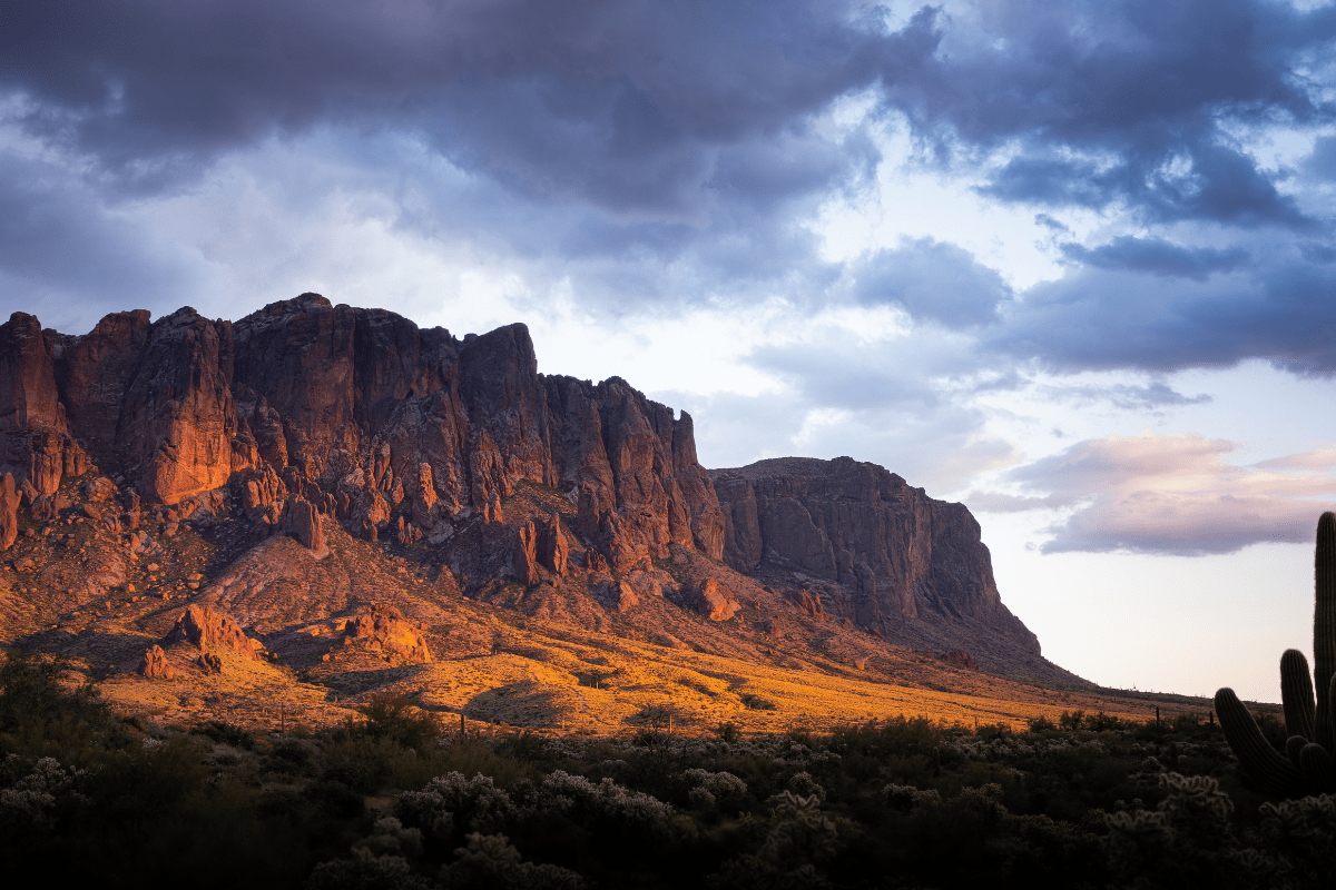

Arizona's East Valley delivers some of the Southwest's most accessible desert hiking, with world-class trails minutes from Gilbert, Mesa, Chandler, and Tempe. From challenging summit climbs with panoramic city views to family-friendly loops around urban lakes, these trails showcase stunning Sonoran Desert beauty while providing year-round outdoor recreation opportunities. But with over 200 annual mountain rescues and 121 days exceeding 105°F in 2024, understanding trail specifics and safety requirements is essential before hitting those dusty paths.
Why the East Valley rocks for hiking
Let's be honest: Phoenix didn't become the third-best hiking city in America by accident. The East Valley alone offers over 200 miles of maintained trails within a 30-minute drive from any major city. Whether you're a weekend warrior or someone who considers walking to the mailbox cardio, there's genuinely something here for everyone.
The region's trail infrastructure is legitimately impressive. You can access everything from wheelchair-accessible paved paths to extreme scrambles requiring actual handholds and questionable life choices. But here's the thing nobody tells you: timing is absolutely everything in desert hiking, and showing up unprepared is a recipe for becoming one of those 200+ annual rescue statistics.
Easy trails that won't destroy you
These trails are perfect for families, beginners, or anyone who wants beautiful scenery without questioning their life choices halfway up a mountain.
Gilbert Riparian Preserve at Water Ranch
Here's a secret: not every great hike requires climbing mountains. The Gilbert Riparian Preserve proves that spectacular nature experiences exist right in suburban Gilbert. This 110-acre preserve features 2.5 miles of interconnected trails with virtually no elevation gain (just 6 feet total), making it perfect for strollers, wheelchairs, or anyone who appreciates flat ground.
Located at 2757 E. Guadalupe Road, this free urban oasis showcases seven fishing ponds, over 150 documented bird species, and the Gilbert Rotary Centennial Observatory for stargazing. The preserve's paved paths wind past water features that are genuinely rare in the desert, creating exceptional photography opportunities, especially during sunrise and sunset.
What makes this place special:
- Completely free admission and parking
- Wheelchair and stroller accessible throughout
- Kids' dinosaur dig area
- Monthly guided bird walks
- Autism-friendly certified facility
The best part? It's open year-round, though summer visits require early morning timing unless you enjoy feeling like a rotisserie chicken.
Veterans Oasis Park in Chandler
Veterans Oasis Park demonstrates how creative water management creates legitimate hiking opportunities. This 113-acre park at 4050 E. Chandler Heights Road features 2.1 to 4.5 miles of completely flat trails winding around a 5-acre community fishing lake and 78 acres of groundwater recharge basins that actually look pretty cool.
The Solar System Walk includes scale planetary monuments (Neptune is surprisingly far), while the Chandler Nature Center showcases desert wildlife including a desert tortoise habitat. With seven van-accessible parking spaces, 6-foot-wide paved paths, and surfaces designed for strollers, this preserve excels at accessibility.
Why families love this place:
- 153 documented bird species
- Free fishing (license required)
- 6 a.m. to 10:30 p.m. hours
- No elevation gain whatsoever
- Monthly guided nature walks
Papago Park's Hole-in-the-Rock Trail
The famous Hole-in-the-Rock Trail requires just a 0.3-mile walk with 200 feet of elevation to reach a wind-eroded cave formation that served as an ancient Hohokam calendar site. This 10-minute hike is manageable for ages "1 to 99" according to AllTrails reviewers, though that might be slightly optimistic.
The iconic photo opportunity (sitting in the hole with the city skyline behind you) has made this one of Phoenix's most Instagrammed locations. Fair warning: parking is absolutely brutal, so arriving before 9 a.m. on weekends isn't a suggestion, it's survival.
Moderate trails for the reasonably ambitious
These trails offer legitimate workouts without requiring mountaineering skills or existential crises.
Wind Cave Trail: The East Valley crown jewel
Wind Cave Trail in Usery Mountain Regional Park stands as the East Valley's most beloved moderate hike, earning a 4.6-star rating from nearly 11,000 AllTrails reviews. This 3.2-mile out-and-back trail climbs 763 feet through dense saguaro forests to reach a wind-carved cave offering panoramic views of Phoenix, the East Valley, and even the Fountain Hills fountain on clear days.
The trailhead sits at Usery Mountain Regional Park at 3939 N. Usery Pass Road in Mesa. The trail's moderate rating comes with caveats: steep rocky switchbacks dominate the upper section, requiring some scrambling to reach the cave itself. Most hikers complete the journey in 2-3 hours, though families with children as young as three have successfully made the climb with adequate rest breaks.
Critical Wind Cave intel:
- $7 vehicle fee (or $85 annual pass)
- Parking fills by 8 a.m. weekends
- Overflow parking available along Pass Mountain Loop
- Some scrambling required at the cave
- Restrooms and water at trailhead
A Mountain (Hayden Butte) in Tempe
A Mountain provides Tempe's signature hiking experience in just 0.9 miles with 285 feet of elevation gain. This moderate trail near ASU's campus features over 500 ancient Hohokam petroglyphs and the famous painted "A" visible throughout the valley. Starting from the College Avenue and Curry Road trailhead, hikers navigate narrow stairways and steep rocky sections to reach 360-degree views encompassing downtown Tempe, the Phoenix skyline, and Sky Harbor Airport.
The 30-minute average completion time makes this perfect for a quick workout, though crowds are constant given its central location and free parking. Pro tip: early morning visits offer the best lighting for photography and slightly fewer crowds of ASU students recovering from questionable life choices.
Pass Mountain Loop Trail
For those wanting more distance, the Pass Mountain Loop Trail offers a 7.4-mile circuit around the mountain locals call "Scarface." This trail provides 728 feet of elevation gain through some of the densest saguaro forests in the region, with multiple access points allowing hikers to customize their distance.
Mountain bikers share this multi-use trail, and clockwise hiking is recommended for gentler inclines. The same parking areas and fees apply as Wind Cave, with the bonus of generally lighter crowds than the more famous cave trail.
Trails that'll make you question your choices (in a good way)
San Tan Mountain Regional Park
San Tan Mountain Regional Park straddles the border between Queen Creek and the East Valley cities, offering 10,200 acres of Sonoran Desert with over 18 miles of multi-use trails. The park's most popular route, the Goldmine and Dynamite Trail Loop, covers 4.7 miles with 739 feet of elevation gain while passing historic miners' graves where Mansel Carter and Marion Kennedy rest.
Located at 6533 W. Phillips Road in Queen Creek (about 20 minutes from Gilbert or Chandler), the park charges the standard $7 vehicle fee, though some trailheads outside the park boundary offer free access. The visitor center features educational exhibits and a desert tortoise habitat, while the trail system accommodates hikers, mountain bikers, and equestrians on well-marked paths.
What makes San Tan special:
- Historic mining sites and graves
- Mica and pyrite deposits that sparkle
- Views of Phoenix and San Tan Valley
- Multiple trail difficulty options
- Less crowded than Usery Mountain
The regional heavy hitters worth the drive
While technically outside the immediate East Valley, Camelback Mountain ranks as Phoenix's most famous hike. Fair warning: this trail features 1,420 feet of elevation gain in just 2.5 miles, requiring actual scrambling and hand-over-hand climbing. With 26,000+ AllTrails reviews warning about crowds that necessitate arrival before 7 a.m. on weekends, this isn't for casual hikers or anyone afraid of heights.
South Mountain Park, the nation's largest municipal park at 16,000+ acres, offers more accessible adventures through multiple Chandler and Tempe entry points. The Mormon Trail to Fat Man's Pass provides a moderate 2-4 mile hike featuring natural tunnels, petroglyphs, and Hidden Valley access.
Desert safety that could save your life
Desert hiking demands serious respect for extreme conditions. Phoenix recorded 121 days over 105°F in 2024, with 45 days requiring trail closures. The city's heat safety program mandates 8 a.m. to 5 p.m. closures at Camelback Mountain and Piestewa Peak during Excessive Heat Warnings, while dogs are prohibited on all city trails when temperatures reach 100°F.
Water and timing requirements
Hydration requirements far exceed normal expectations: the Arizona Department of Health Services recommends 1-2 liters per hour of summer hiking activity, with electrolyte supplementation essential to prevent hyponatremia. The optimal hiking window runs October through March, though dedicated desert hikers start before dawn year-round, sometimes as early as 4:30 a.m. in summer to complete trails before dangerous heat arrives.
Essential desert hiking gear:
- Minimum 1 gallon water per person
- Wide-brim hat and SPF 30+ sunscreen
- Broken-in hiking boots with ankle support
- Offline maps downloaded to phone
- Someone knowing your planned route
Wildlife reality check
Wildlife encounters peak during monsoon season (July-September) when rattlesnakes are most active and flash flood risks escalate in washes and canyons. The 13 rattlesnake species in Arizona generate over 300 relocation calls annually in Phoenix alone. Despite common myths, baby rattlesnakes are not more dangerous than adults, though all should be given wide berth on trails.
Javelinas, despite their fearsome appearance, have poor eyesight and typically flee when encountered, while mountain lion sightings remain extremely rare. The key is staying alert and making noise on blind corners.
Making your East Valley hiking adventure happen
Success on East Valley trails starts with realistic timing. Arrive at popular trailheads by 7:30 a.m. on weekends or consider weekday hiking for dramatically reduced crowds. Download offline maps before departing as cell service varies wildly, and always inform someone of your planned route and return time.
Most trails require either the $7 Maricopa County Parks day pass or remain free within city limits, though annual passes offer genuine value for frequent hikers. REI in Tempe at 1405 West Southern Avenue provides gear and expert local advice, while organizations like the Arizona Hiking Shack and Phoenix Area Hiking Club offer group hikes and insider knowledge about hidden gems and current trail conditions.
Whether seeking a challenging summit climb with sweeping metropolitan views or a peaceful morning stroll around urban wetlands, the East Valley's diverse trail system delivers year-round hiking opportunities. These trails showcase the Sonoran Desert's unique beauty while remaining remarkably accessible to millions of Valley residents. With proper preparation, respect for desert conditions, and early morning starts, hikers of all abilities can safely explore this remarkable landscape where ancient petroglyphs, towering saguaros, and panoramic vistas await just minutes from home.
The desert doesn't mess around, but neither should you when it comes to experiencing some of the most spectacular hiking in the Southwest. Just remember: start early, bring more water than seems reasonable, and embrace the fact that you're hiking in one of the most beautiful and unforgiving environments on Earth.