With rivers, mountains, and dense pine forests cocooning the city, it’s no surprise that Missoula is a paradise for hikers. Whether you’re after a quick stroll, an uphill challenge, or a multi-mile trek into the wild, there’s a trail close by ready to show off Montana’s best scenery.
Let’s get to it.
Sousa Trailhead
Tucked at the edge of Missoula, Sousa Trailhead offers a compact but varied trail system. The parking lot at 475 Spanish Peaks Drive is free, so it fills up early on weekends—arrive before mid-morning or prepare for tight parking spots. There are no restrooms or water stations, so visitors should bring their own water.
The dirt singletrack weaves between grassy slopes and shady pine thickets, with enough rocky switchbacks to challenge your calves. The 1.1-mile Sousa Trail provides an intermediate workout, while the Woodsy Spur remains friendly for beginners. All paths interconnect, letting hikers craft custom loops. For a longer adventure, the Mount Dean Stone Loop spans about 11 miles round trip, rising steadily to reveal wide valley views and glimpses of the Bitterroot Range.
Off-leash dogs thrive here, chasing scents and making new friends. Benches appear early on for quick breaks or a glance at wildflowers. City crews maintain the trail network well, keeping scenery classic and crowds manageable unless the weather is perfect.
Grant Creek trail
Situated just outside Missoula, Grant Creek Trail offers a paved, 3.3-mile one-way route alongside Grant Creek Road. The gently rolling surface tilts up to a 9% grade at its steepest points, enough to get your heart rate up without feeling overwhelming. The path measures six feet across in smooth asphalt and concrete, making it welcoming for walkers, cyclists, strollers, and wheelchairs.
A section near I-90 shows some cracks and could use repairs, so save your best rollerblades for elsewhere. The scenery alternates between wooded creekside stretches and open pastures, with viewpoints such as Bluebird Preserve adding interest. Carved benches and interpretive signs provide rest stops and nature information.
Traffic is usually light despite the proximity to the road, and dogs on leash are welcome. The trail is open year-round, though the southern half lacks shade and can get icy in winter. Maintenance by the city and county is consistent up to I-90 but thins out beyond. Parking is convenient at the Elk Foundation lot. Overall, it’s a solid choice for a leisurely walk or an easy bike ride.
Duncan Drive Trailhead
Acting as the gateway to the Rattlesnake Recreation Area, Duncan Drive Trailhead includes a tidy parking lot with 15 spaces and plans for expansion. Informational boards cover Indigenous history and the nearby dam-removal project. Accessibility features include a one-mile handcycle-friendly path, wide gates, and gentle turns for wheelchair users.
Trails range from the brief out-and-back Duncan Bridge section—700 feet of singletrack over a pedestrian bridge—to the extensive 31-mile Sheep Mountain Loop. That longer route includes river fords, wildflower meadows, and sustained climbs. Dogs are welcome year-round; on the Sheep Mountain Loop they must remain on leash.
Trail signage remains clear throughout the network, and maintenance crews keep routes in good condition. In winter, the area opens for snowshoeing and Nordic skiing, thanks to well-groomed tracks. Whether planning a quick stroll or a multi-day trek, Duncan Drive Trailhead delivers scenic variety and a truly inclusive experience.
John H Toole Riverfront Park
Situated along the Clark Fork River, John H Toole Riverfront Park spans about 12 acres of grassy fields and river views. A paved riverfront path runs through the park, linking to a seven-mile paved system for longer rides or runs. Parking is available on-site, and restrooms stand ready for visitors of all ages.
Within the park, a 400-meter sand running track sees heavy use by local runners who appreciate its forgiving surface. Easy nature loops of dirt and gravel wind past native grasses and occasional wildflower patches in spring and summer. Benches and interpretive signage appear along both paved and unpaved routes.
Weekend crowds concentrate on the riverfront trail, but smaller prairie loops offer quieter escapes. The paved sections remain fully accessible, while the sand track can challenge those with mobility concerns. Overall maintenance stays solid, making this park a reliable spot for jogging, dog walking on leash, or family outings.
Rattlesnake Trailhead
Serving as a hub north of Missoula, Rattlesnake Trailhead features a large parking lot, restrooms, and posted maps. The main path begins as a flat, wide gravel corridor that welcomes strollers and bikes for the first couple of miles. Accessible toilets appear at the trailhead and again 1.5 miles in.
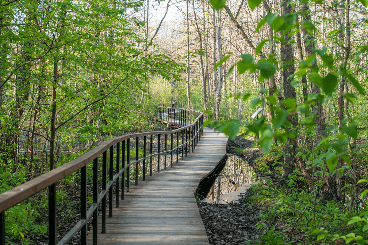
Beyond the initial stretch, side trails branch into forested ridges and wildflower meadows for more strenuous outings. Main-corridor hikers can turn back at any point, while ambitious adventurers will find routes extending up to 18 miles—or even 30+ miles when linking multiple spurs. Most surfaces are packed dirt and gravel, with occasional rocky sections or boardwalks over swampy ground.
Crowds peak near the parking area on summer weekends but thin out quickly on less-traveled loops. Dogs are welcome from March through November, on leash in the first segment. In winter, cross-country skiers take over as the trail receives weekly grooming. This mix of accessibility, variety, and seasonal change keeps Rattlesnake Trailhead busy year-round.
The M
Climbing Mount Sentinel, the M Trail covers 0.75 miles of steep singletrack just behind the University of Montana. The route ascends through 13 tight switchbacks with little relief in grade. Hikers often wonder within the first few minutes whether the effort will ever ease.
Views arrive quickly over the Clark Fork River, the city, and the Rattlesnake Mountains. The iconic concrete “M” measures 125 by 100 feet and marks a natural turnaround point. Those seeking extra elevation can continue another 680 feet to the summit for broader panoramas.
Benches at several switchbacks offer rest stops during the relentless climb. Expect heavy foot traffic—this trail can see more than a thousand hikers per day. Dogs are welcome on leash, but water sources and shade are nonexistent. Maintenance falls to university crews and local volunteers, ensuring the path stays clear but free of amenities. The M Trail remains a true Missoula classic: short, steep, and undeniably rewarding.
Pattee Canyon Recreation Area
Spanning 3,200 acres, Pattee Canyon Recreation Area boasts 27 miles of trails winding through ponderosa pines. The main Pattee Canyon Trail covers eight miles out and back, alternating between rocky and smooth sections. It’s a steady climb that rewards you with classic forest scenery and calf-burning exercise.
For a shorter option, the Sam Braxton Trail delivers 3.5 miles of shaded paths under old-growth larch. Along the way, you’ll encounter bits of pioneer history and wildflower displays that brighten the forest floor in season.
Adventure seekers may take the wide dirt road up Crazy Canyon. It gets steep near the top but offers spacious views of the valley below. Leashed dogs are welcome and owners must carry out waste.
Picnic tables and basic restrooms are available, but bring your own water. Trail maintenance by the Forest Service keeps routes clear, and weekday visits tend to be quiet. Whether covered in snow or dusted in pine needles, this area accommodates hikers of all preferences.
Lincolnwood Trailhead
Lincolnwood Trailhead offers a peaceful, shaded escape along Rattlesnake Creek with 2 to 3 miles of interconnected loops. Clear signage ensures you won’t stray off course. The wide dirt and gravel paths remain mostly flat, though you’ll encounter gentle hills near the small dam and sway-inducing suspension bridge crossings.
The canopy of pines opens out onto fields where cows graze and waterfowl float in creek pools. That creek is popular for cooling off on hot days. Strollers manage the terrain well, though wheelchairs may feel every bump past the initial loop.
A kiosk and parking lot at the trailhead provide easy access. Keep an eye out for dog waste—cleanup stations are limited. Weekends can bring families, bikers, and pooches, but the trail network spreads everyone out. Whether you’re seeking a short nature break or a longer ramble, this area delivers a relaxed creekside route.
Blue Mountain Trailhead
Serving as a gateway to Missoula’s outdoor options, Blue Mountain Trailhead has something for every energy level. The Nature Trail is a 0.4-mile loop with interpretive signs spaced along a well-marked path. It’s perfect for a quick stroll and a glimpse at local flora and fauna.
For a more challenging adventure, the summit trail to Blue Mountain Lookout spans over 10 miles with more than 2,000 feet of elevation gain. The reward comes in sweeping views of the Missoula Valley and Bitterroot Range. Along the way, routes like Rocky Top and Deadman Ridge see lighter foot traffic and occasional wildlife sightings, including deer or even elk.
Dogs can roam off-leash in designated areas, but pay attention to leash requirements near wildlife zones. The parking area is rustic—pack water and plan for minimal restroom facilities. Trail upkeep is reliable, with cleared paths, updated maps, and a wheelchair-accessible viewing platform on the Nature Trail.
Maclay Flat Nature Trail
Offering relaxed terrain just outside Missoula, Maclay Flat Nature Trail features two flat loops of 1.25 and 1.8 miles. Both routes use solid gravel that stays wide enough for side-by-side walking. The grade never exceeds 1%, making the trail fully accessible for wheelchairs and strollers. Accessible parking and vault toilets are in place, and the Forest Service keeps the gravel in good condition after winter weather.
The trail runs along the Bitterroot River, with riverfront benches set at intervals for a casual sit-down. Ponderosa pines, cottonwoods, distant mountain views, and interpretive signs add variety. Birdwatchers and wildflower enthusiasts appreciate the quiet habitat. Dogs on a leash are permitted but bring your own waste bags.
Early mornings or weekdays offer the best chance at solitude, as the trail can see more visitors when the weather is nice. Spring floods can leave sections wet, so plan accordingly. Overall, this route is ideal for a gentle, informative outing near town.
Bluebird Preserve Trailhead
Nestled on Missoula’s edge, Bluebird Preserve Trailhead offers a quieter alternative to the busier North Hills. A 2.3-mile loop links the Bluebird, Overlook, and Red Tail trails, but you can explore about four miles of packed-dirt paths in total. The gradual climb gains roughly 429 feet to the overlook. The slope stays moderate, allowing conversation without becoming breathless most days.
Mountain bikes and motorcycles are not allowed. Instead, hikers share the wide trail with equestrians, leashed dogs, and local deer. Interpretive signs identify plants such as Missoula Phlox, and a small unpaved parking lot contains informational panels.
There are no restrooms or drinking water on site. Visitors will find a single bench at the overlook.
Late spring brings clusters of wildflowers, while fall colors emerge later in the year. These seasons draw more visitors, yet the area remains less crowded than other local options. Trails can turn muddy after rain. From October through March, winter closures protect wildlife. Overall, this simple trail system provides consistent natural scenery and an easy climb.


